



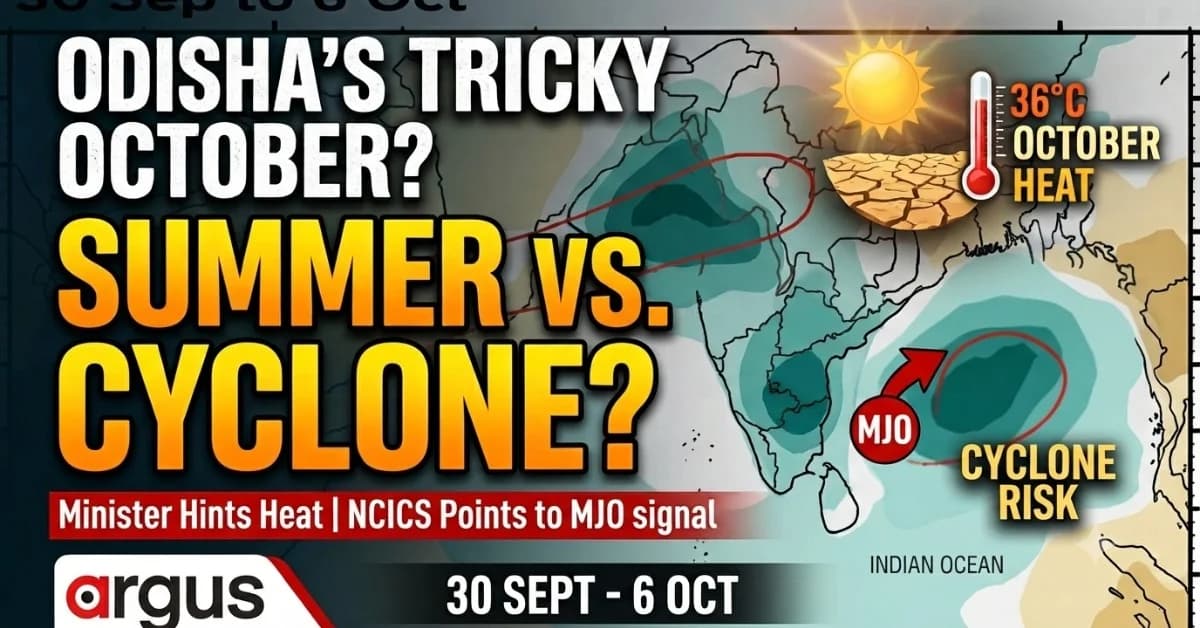
Exclusive| Odisha Min Suresh Pujari Hints Early Monsoon Exit May Bring ‘October Summer’ to Odisha; NCICS Sees Active MJO in Early Oct Triggering Cyclone in Bay?
Key Points
Ministers hint at persistent October heat reaching up to 36°C. NCICS highlights crucial MJO signals influencing regional weather. Rising concerns over a potential cyclone risk during the transition period.
Bhubaneswar: Is Odisha heading into an unusually tricky October weather transition this year?
On one side, Odisha Revenue and Disaster Management Minister Suresh Pujari on Thursday hinted at an early withdrawal of the southwest monsoon, saying it could expose the state to a sudden spell of oppressive, humid “second summer” or October heat.
On the other is the latest North Carolina Institute for Climate Studies (NCICS) atmospheric signal, which points towards a strong convective phase of the Madden-Julian Oscillation (MJO) entering the Indian Ocean during the first week of October.
That distinction matters.

📱 Get Argus News App
✨A premature monsoon retreat would favour clearer skies, stronger solar heating and a rapid rise in daytime heat. But if the atmosphere simultaneously retains a strong tropical convective signal, Odisha and the Bay of Bengal could instead see renewed moisture, low-pressure development and an enhanced late-season cyclogenesis environment.
The result is not necessarily a choice between “summer” and “cyclone”.
October could potentially deliver both — but at different stages of the transition.
The latest NCICS forecast shows persistent convective activity through mid-September, a delayed weakening of the monsoon regime towards late September and then a renewed, deep convective signal around September 30–October 6.
That creates an important meteorological question for Odisha:
What happens if the monsoon begins withdrawing early, but the tropical atmosphere refuses to switch off?
The Two October Scenarios
The Minister’s warning and the NCICS signal are actually describing two different parts of the atmospheric transition.
| Weather Signal | What It Means for Odisha | Likely Consequence |
|---|---|---|
| Early monsoon withdrawal | Rainfall and cloud cover decline earlier | Rapid heating |
| Wet soil left behind by monsoon | Moisture remains close to the surface | High humidity |
| Clear skies after withdrawal | More direct solar radiation reaches land | Daytime temperatures rise |
| Weak/stagnant winds | Heat and moisture remain trapped | Higher heat index |
| Active MJO in Indian Ocean | Deep tropical convection and moisture increase | Greater low-pressure potential |
| Active MJO + favourable Bay conditions | Reduced shear and enhanced atmospheric spin | Cyclogenesis risk rises |
| Delayed withdrawal | Persistent cloud/rain suppresses immediate heat | Cooler but wetter transition |
| Withdrawal followed by clear skies | Heat builds rapidly | “October summer” |
So, the real uncertainty is not whether one forecast is right and the other wrong.
It is whether the atmosphere manages to transition cleanly from the southwest monsoon into the post-monsoon regime - or whether the transition becomes compressed, volatile and punctuated by tropical disturbances.
What the NCICS Forecast Is Actually Showing
The latest seven-day OLR outlook cited in the inputs provides an important clue.
Outgoing Longwave Radiation is a useful indicator of deep convection. Negative OLR anomalies generally indicate enhanced cloudiness and convection, while positive anomalies are associated with suppressed convection and clearer, drier conditions.
The NCICS sequence shows three broad stages:
| Period | NCICS Signal | What It Suggests |
|---|---|---|
| Sept 9–22 | Persistent cloud formation | Active convection remains |
| Sept 23–29 | Increasing dry suppression over parts of India | Monsoon transition begins |
| Sept 30–Oct 6 | Deep convective/MJO signal over Indian Ocean and southern peninsula | Tropical activity potentially re-energises |
The most striking part is the late September–early October reversal.
The atmosphere may begin moving towards a drier post-monsoon structure, but an active MJO pulse could arrive just as that transition is underway.
That is why the first week of October deserves attention.
Why the MJO Matters to the Bay of Bengal
The Madden-Julian Oscillation is not a cyclone by itself.
It is a large-scale tropical wave of enhanced and suppressed convection that travels eastward around the equatorial region.
But when its active convective phase reaches the Indian Ocean during the post-monsoon cyclone season, it can create a more favourable background environment for tropical disturbances.
Research notes that October is already the peak of the North Indian Ocean’s post-monsoon cyclogenesis season and identifies MJO phases 1, 2 and 3 over the Indian Ocean as particularly important.
The atmospheric mechanism described in the inputs is straightforward:
Active MJO → more tropical convection → enhanced low-level vorticity + reduced vertical wind shear → greater potential for organisation and rapid intensification.
The study summary says rapid-intensification episodes were about four times more frequent when the MJO was active over the Indian Ocean in phases 1–2 than when it was positioned over the Pacific in phases 6–7.
That does not mean a cyclone is inevitable.
It means the background environment can become substantially more supportive if a suitable low-pressure disturbance forms.
The October Contradiction: Heat Outside, Cyclone Fuel Inside
This is where Odisha’s October story becomes complicated.
The classic “October heat” mechanism needs:
clear skies + wet land + intense solar radiation + high humidity + weak winds.
The cyclone mechanism, meanwhile, benefits from:
warm ocean + deep convection + atmospheric moisture + low vertical wind shear + sufficient low-level rotation.
These conditions can coexist during a transitional month.
The land can begin drying and heating after monsoon withdrawal while the Bay of Bengal remains warm and dynamically active.
Therefore, an early withdrawal does not automatically mean a calm October.
It can instead produce a rapid transition in which:
The land begins heating.
Humidity remains high.
Tropical moisture remains available.
An MJO pulse enhances convection over the Indian Ocean.
A low-pressure area develops over the Bay.
Atmospheric conditions determine whether that system weakens, intensifies or moves towards the coast.
Odisha’s Own History Shows Why October Cannot Be Read From One Signal
Historical IMD data available for Odisha shows that the monsoon’s final withdrawal has varied substantially from year to year.
The normal window identified has been October 10–15, but several years have seen withdrawal substantially later.
Odisha: 15-Year Monsoon Withdrawal and October Heat Matrix
| Year | Final Withdrawal from Odisha | October Daytime Maximum | Weather Character |
|---|---|---|---|
| 2025 | Oct 15–17 | 32–34.5°C | Sudden clearing and high heat index |
| 2024 | Oct 18–19 | 33–36°C | Extremely warm October; warm nights |
| 2023 | Oct 19 | 32.5–34°C | About 1.5°C above normal |
| 2022 | Oct 22–23 | 32–34°C | Delayed retreat, humidity spike |
| 2021 | Oct 24–25 | 31.5–33°C | Very delayed transition |
| 2020 | Oct 26–28 | 33–35°C | Highly delayed retreat |
| 2019 | Oct 16–17 | 32.5–34.5°C | Rapid post-monsoon warming |
| 2018 | Oct 21 | 32–34°C | Late high-pressure build-up |
| 2017 | Oct 17–19 | 31.8–33.5°C | Humid “second summer” |
| 2016 | Oct 28 | 33–35.5°C | Monsoon lingered unusually long |
| 2015 | Oct 29 | 32.5–34°C | Delayed withdrawal |
| 2014 | Oct 18 | 32–33.8°C | Slightly late withdrawal |
| 2013 | Oct 23–24 | 31–33°C | Cyclone Phailin disrupted October heat |
| 2012 | Oct 18 | 32–34°C | Severe heat after clearing |
| 2011 | Oct 13–14 | 31.5–32.5°C | Closest to normal baseline |
Source: IMD-based historical dataset
The Historical Lesson: October Has Two Personalities
The table reveals something important.
October heat is not simply a consequence of an early monsoon withdrawal.
Odisha has experienced oppressive heat even after late withdrawals, because the delayed monsoon can leave enormous quantities of moisture over the land. Once the clouds clear, that moisture can turn into a powerful humidity-driven heat index.
The historical data places the long-term October daytime maximum baseline around 31.5–32°C, while recent Odisha observations in key areas frequently reach 33–36°C.
That explains why the Revenue Minister’s warning cannot be dismissed simply because the monsoon might not disappear immediately.
The question is what happens immediately after the clouds and rain retreat.
Why Wet Soil Can Make October Feel Like Summer
The October heat mechanism, however, is different from May’s dry heat.
In May, the atmosphere and land are generally much drier.
After the monsoon, however, the ground can remain saturated.
When clear skies return, intense solar radiation heats the land.
That heat drives evaporation.
The sequence becomes:
Direct sunlight → evaporation → rising humidity → reduced sweat evaporation → higher apparent temperature.
Thus, a thermometer reading of around 33°C can feel considerably hotter when humidity is very high.
This is the “sauna effect” behind the phrase October Heat.
But the Bay Follows a Different Clock
While Odisha’s land surface may be moving towards a hotter, drier regime, the Bay of Bengal does not necessarily make the transition at exactly the same time.
October is historically a major post-monsoon cyclone month.
The NCICS identifies the southeastern Bay/Andaman Sea region as an important genesis area, broadly around 8°N–14°N and 85°E–95°E, where a developing system can obtain a long stretch of warm ocean over which to organise.
This is particularly significant if the MJO’s active convective phase is present.
And Then Comes the Track Question
Even if an October low-pressure system develops, development does not automatically mean an Odisha landfall.
The ultimate destination depends on the larger atmospheric steering pattern, particularly the subtropical ridge and upper-air circulation.
Historical data analysis identifies three broad possibilities:
| Track | Basic Movement | Potential Impact Zone |
|---|---|---|
| A — Northwest | Andaman/southeast Bay → central Bay → northwest | Odisha / West Bengal |
| B — Recurving north | Central Bay → north/northeast | West Bengal / Bangladesh / Myanmar |
| C — Westward | Bay → west or west-southwest | Andhra Pradesh / Tamil Nadu |
Track A is particularly relevant to Odisha because a system moving northwest from the central or southeastern Bay can approach the Odisha coast.
Historical examples are Cyclone Dana in 2024 and Cyclone Phailin in 2013 for broad northwestward Odisha-facing track structures.
But this remains a conditional risk, not a forecast of an October cyclone.
Dana 2024: A Reminder of the October Equation
Cyclone Dana provides a recent Odisha example of how the October atmosphere can rapidly become complicated.
The IMD historical data shows that operational outlooks during October 2024 highlighted an MJO Phase 3 signal with strong amplitude, while a low-pressure system was developing over the central Bay.
That system eventually intensified into Severe Cyclonic Storm Dana and moved towards the Odisha-West Bengal coast.
Interestingly, the year 2024 began with peak El Niño in January 2024, and by October, ENSO turned neutral. IMD historical data records October 2024 as the hottest October in Odisha and India, just as Minister Suresh Pujari is hinting at October 2026.
The significance for 2026 is not that another Dana is coming.
There is no basis in the supplied NCICS signal to make that claim.
The lesson is narrower:
When the October tropical background becomes favourable, a low-pressure system that might otherwise struggle can find a much more supportive atmospheric environment.
Only when several of these signals line up can the risk of a significant cyclone begin to become clearer.
The Real October Dilemma for Odisha
The Minister’s warning therefore represents one side of the transition.
If the monsoon withdraws prematurely and the atmosphere clears rapidly, Odisha could experience the classic sequence:
Early retreat → intense sunlight → wet soil → evaporation → high humidity → October heat.
But the NCICS signal introduces a second possibility:
Late September transition → active MJO arrives → renewed convection → low-pressure formation potential → enhanced Bay cyclogenesis environment.
And these two processes do not necessarily contradict each other.
They can occur within the same fortnight.
That is precisely what makes the first week of October worth watching.
The Bigger Picture: Odisha May Not Get a Clean Seasonal Handover
The historical record shows that Odisha’s monsoon withdrawal has repeatedly moved deep into October, while October temperatures have also frequently risen above the long-term baseline.
At the same time, the NCICS outlook points to a potentially active tropical phase around September 30–October 6.
So, the state’s October problem may not be simply:
“Will summer return early?”
Nor is it yet:
“Will another cyclone hit Odisha?”
The more scientifically defensible question is:
Will Odisha experience a compressed and unstable transition - with land heating rapidly even as the Bay remains capable of producing late-season disturbances?
For now, the evidence supports heightened monitoring rather than a cyclone prediction.
The next decisive signals will come from the actual monsoon withdrawal, the evolution of the MJO, and whether a genuine low-pressure area emerges over the Bay during the early-October window.
Bottom Line
Odisha could be caught between two atmospheric clocks this October - the retreating monsoon clock over land and the MJO-driven tropical clock over the Indian Ocean and Bay of Bengal.
If the first accelerates while the second remains active, the state could see a volatile transition in which “October summer” and cyclone risk become two sides of the same seasonal change.
Related Topics
Explore more stories