



MJO Comes Over Bay of Bengal in September Last: Will Its Spark Cyclone Genesis in October?| Exclusive
Key Points
El Niño strongly suppresses post-monsoon Bay of Bengal cyclone activity, but historical records show it does not entirely eliminate it.
An active MJO phase can temporarily counter hostile El Niño conditions by increasing moisture, reducing wind shear, and boosting low-level vorticity.
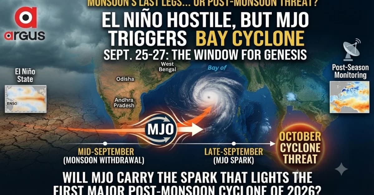
Long-range models project the MJO to emerge into Phase 3 near the Bay of Bengal around September 25–27, 2026, serving as a potential late-month trigger.
Bhubaneswar: In the El Niño year, the Monsoon 2026 is on its last legs. The advent of September brings the countdown to the withdrawal of the southwest monsoon over the Indian subcontinent.
But at the same time, September also brings another nagging question into focus – the heralding of the post-monsoon cyclonic season for India's east-coast states, particularly Odisha, Andhra Pradesh and West Bengal.
Historically, the Bay of Bengal becomes increasingly conducive to tropical cyclone formation during October-November. Yet the background climate matters.
The historical record available for the years1987-2025 contains 12 El Niño years. Seven of those years saw a significant post-monsoon Bay of Bengal cyclone affecting the eastern Indian region: 1987, 1991, 2002, 2006, 2014, 2018 and 2023.

📱 Get Argus News App
✨The remaining El Niño years in the compilation – 1994, 1997, 2004, 2009 and 2015 – did not produce a comparable September-November cyclone impacting the target east-coast states.
The contrast with La Niña is stark. Of the nearly 14 La Niña years in the same historical window, the data records 13 with Bay of Bengal cyclone activity. Among 13 neutral years, 11 recorded cyclone genesis or significant cyclone activity in the Bay.
The broad message is therefore clear: El Niño suppresses Bay of Bengal cyclone activity, but it does not eliminate it.
Research on the 1972-2015 record similarly found that post-monsoon cyclone frequency, accumulated cyclone energy and cyclone days are substantially lower during El Niño than La Niña. The mean number of cyclone days was about 3.68 days in El Niño years against 7.64 days in La Niña years.
So, with 2026 unfolding under a very strong El Niño background, the question is not whether the Bay can produce a cyclone at all. The more intriguing question is: can a powerful intraseasonal pulse override that hostile background?
And this is where the Madden-Julian Oscillation, or MJO, enters the picture.
El Niño + MJO = Mojo for Cyclone Genesis
The MJO is essentially a moving pulse of enhanced and suppressed tropical convection that travels eastward around the equatorial belt. For the Bay of Bengal, its active phase can temporarily change the atmospheric environment from hostile to favourable for cyclone formation.
A peer-reviewed study specifically examining Bay of Bengal tropical cyclones found that TC activity is significantly enhanced when the convectively active MJO phase is positioned over the eastern Indian Ocean and Maritime Continent. The effect is particularly pronounced during the October-December cyclone season, through changes in deep convection, mid-level humidity, sea-level pressure, low-level winds and vertical wind shear.
This makes the MJO particularly important in an El Niño year.
El Niño tends to create the background environment of greater vertical wind shear, drier mid-levels and suppressed convection. An active MJO can temporarily counter those conditions by increasing moisture, convection and low-level cyclonic circulation while reducing shear.
The historical El Niño cases in gven below show this relationship particularly well:
|
El Niño year |
Post-monsoon Bay cyclone |
MJO evidence |
|---|---|---|
|
1987 |
BOB 05 (Oct), BOB 06 (Nov) |
Reanalysis indicates short-lived MJO/equatorial-wave support |
|
1991 |
BOB 05 (Nov) |
MJO/equatorial-wave background support indicated |
|
2002 |
BOB 04 (Nov) |
Active 30–60-day intraseasonal wave associated with genesis |
|
2006 |
Cyclone Ogni (Oct) |
Active MJO pulse over equatorial Indian Ocean |
|
2014 |
Cyclone Hudhud (Oct) |
Active MJO phase 3/4 environment |
|
2018 |
Cyclone Titli (Oct) |
Strong MJO pulse reached Bay around October 8 |
|
2023 |
Cyclone Mithili (Nov) |
Cyclogenesis occurred despite El Niño background |
The strongest documented cases are 2002, 2006, 2014 and 2018, where an active intraseasonal convective pulse has a clearer physical connection with the cyclone environment. The 2018 Titli case is particularly instructive: research found that the MJO reached the Bay of Bengal on October 8 with enhanced convection and anomalous easterlies, providing the atmospheric trigger for Titli's formation.
In other words, the historical evidence does not support saying that every El Niño cyclone is caused by the MJO. But it does support a more defensible conclusion: when the Bay's ocean is sufficiently warm and a favourable MJO pulse arrives, it can provide the missing atmospheric trigger that El Niño otherwise tends to suppress.
Why an Active MJO Can Flip the Bay's Cyclone Switch
|
Background during El Niño |
Active MJO intervention |
Cyclone implication |
|---|---|---|
|
High vertical wind shear |
Shear can weaken locally |
Developing circulation is less likely to be torn apart |
|
Dry/sinking mid-level air |
Moisture increases through the convective envelope |
Deep thunderstorms can persist |
|
Suppressed convection |
Strong upward motion develops |
Pressure falls and convection organizes |
|
Weak low-level vorticity |
Enhanced low-level cyclonic circulation |
Rotation required for genesis increases |
|
Hostile large-scale environment |
Temporary favourable intraseasonal window |
A low-pressure area can consolidate |
This is why scientists track the MJO not merely through rainfall but through upper-atmospheric signals such as 200-hPa velocity potential. Negative velocity-potential anomalies indicate upper-level divergence, associated with rising motion beneath and enhanced convection; positive anomalies represent upper-level convergence and sinking motion.
The 200-hPa field is particularly useful because it filters out much of the smaller-scale surface noise and allows forecasters to identify the planetary-scale circulation associated with the MJO.
Late September: The MJO Could Be the Missing Trigger
The current setup, however, is far from a classic cyclone-friendly one.
The MJO has been difficult to separate from the exceptionally strong El Niño background. The US Climate Prediction Center said in its latest outlook that the MJO remains active but that its strength and phasing have become increasingly difficult to detect because the strong El Niño has become the overwhelmingly dominant tropical mode. Recent RMM observations showed an MJO signal in Phase 7 with little eastward propagation.
That is important because it means the MJO cannot yet be treated as a clean, independent cyclone signal.
But the story may change as September progresses.
Earlier CPC guidance showed the MJO moving eastward from the Indian Ocean toward the Maritime Continent and indicated that the signal could reorganise after periods of destructive interference with the El Niño background.
For the Bay of Bengal, the critical period is therefore late September rather than the first half of the month.
A tracking of the long-range RMM index models drop a major hint on MJO. It gives the following details.
Timeline: Around September 25 to 27, 2026.
Position: The MJO is projected to progress and emerge into Phase 3 (Indian Ocean / Bay of Bengal).
Amplitude: The pulse amplitude is forecast to strengthen close to 1.0, reaching a favorable threshold to spark new convective activity.
Atmospheric Consequence: This late-month entry into Phase 3 will line up with a favorable negative velocity potential anomaly and multi-atmospheric wave interactions. This indicates that while mid-September remains dry, the last week of September could see a strong, final resurgence of monsoon rainfall and potential cyclogenesis over the Bay of Bengal.
It would be entering a warm, moisture-rich ocean at the precise seasonal window when cyclone genesis normally begins to accelerate.
The physical sequence could therefore be straightforward:
Active MJO approaches → upper-level divergence increases → convection deepens → mid-level moisture rises → low-level vorticity strengthens → pressure falls → a disturbance forms over the Bay → favourable ocean conditions allow further organisation.
This is precisely why the September-end MJO signal deserves close watching.
So, Will September's MJO Spark an October Cyclone?
The answer at this stage is potentially – but the signal is not yet strong enough to call it a cyclone forecast.
What makes the situation noteworthy is the timing. September is expected to close the southwest monsoon season, while October opens the principal post-monsoon cyclone window. As predicted, if the MJO indeed strengthens and reaches the eastern Indian Ocean/Bay of Bengal during the last week of September, it could provide the atmospheric spark.
The historical record offers a warning against dismissing that possibility simply because 2026 is an El Niño year.
El Niño may reduce the odds. It does not shut the Bay of Bengal down.
The real wildcard could therefore be the MJO.
If the late-September pulse arrives with sufficient amplitude, enhanced upper-level divergence, stronger convection, increased moisture and reduced vertical wind shear, the Bay could briefly acquire the ingredients required for cyclogenesis.
And that leaves October 2026 with a question that the atmosphere – not the calendar – will ultimately answer:
Will the MJO merely mark the end of the monsoon, or will it carry the spark that lights the Bay of Bengal's first major post-monsoon cyclone of the season?
Related Topics
Explore more stories