



Odisha Weather Forecast: Kalbaisakhi Likely To Resume From March 25
·6 months ago·2 min read
Key Points
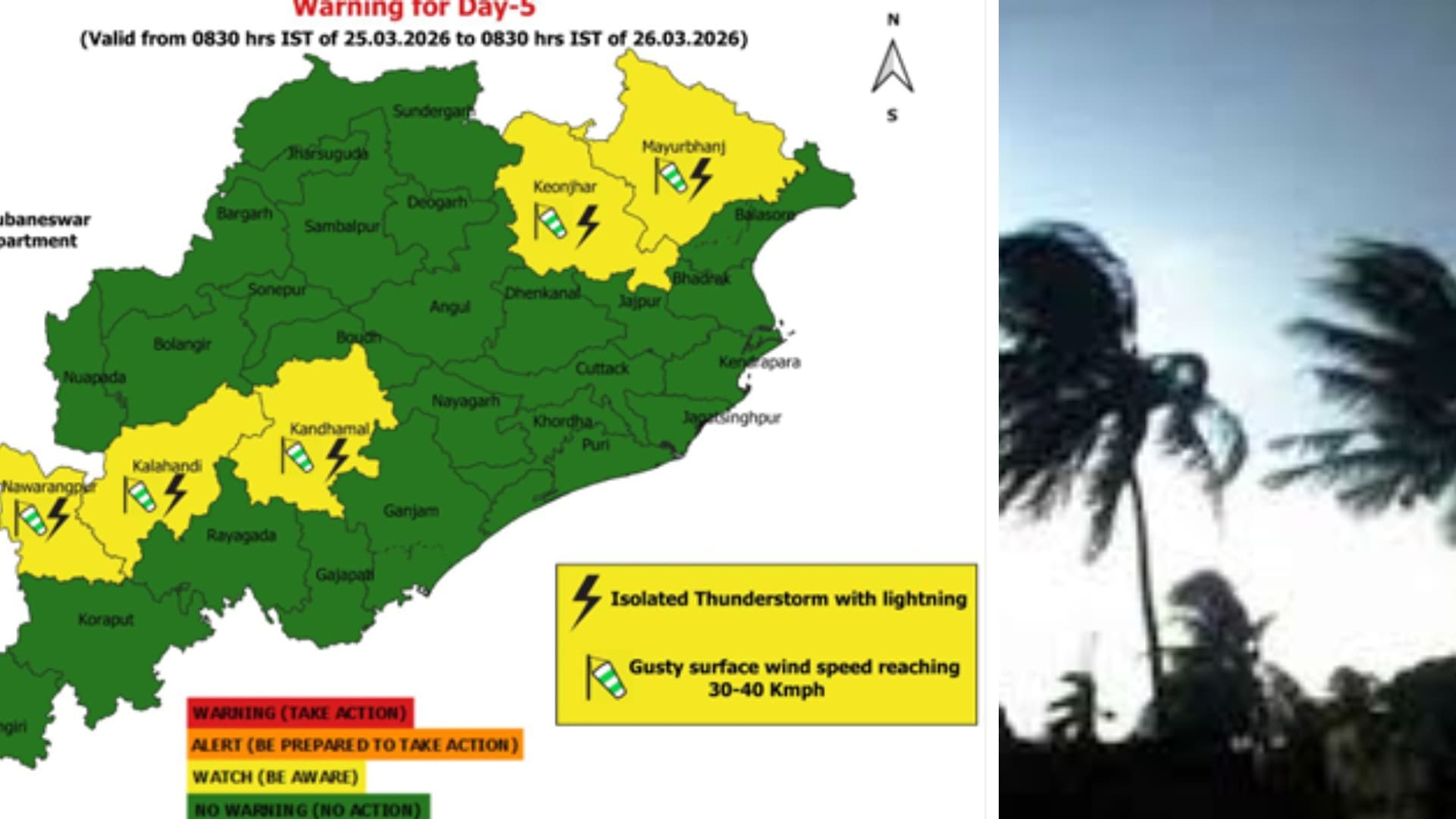
Rainfall activity across Odisha is set to decrease, with a yellow alert for thunderstorms, lightning, and gusty winds (30-40 kmph) in Mayurbhanj and Keonjhar over the next 24 hours.
Bhubaneswar, Mar 22: Rainfall activity across Odisha is set to decrease from Sunday, with the weather department issuing a yellow alert for thunderstorms, lightning and gusty winds in Mayurbhanj and Keonjhar over the next 24 hours.
According to the forecast, wind speeds may reach 30–40 kmph, accompanied by moderate to heavy rainfall at isolated places in these districts.
Wider Rainfall Activity, Dry Spell Ahead
Light to moderate rain or thundershowers are also likely at one or two places across districts, including Balasore, Bhadrak, Jajpur, Kendrapara, Cuttack, Jagatsinghpur, Puri, Khordha, Nayagarh, Ganjam and Gajapati. Dry weather is expected to prevail in the remaining parts of the state.
From 8:30am of March 23 to 8:30am of March 24, the weather agency forecasts light to moderate rain or thundershowers are very likely to occur at one or two places over the districts of Mayurbhanj, Keonjhar, Balasore and dry weather is likely to prevail over the rest districts of Odisha. No warning alert is issued for the given time period.
According to the forecast, wind speeds may reach 30–40 kmph, accompanied by moderate to heavy rainfall at isolated places in these districts.
Wider Rainfall Activity, Dry Spell Ahead
Light to moderate rain or thundershowers are also likely at one or two places across districts, including Balasore, Bhadrak, Jajpur, Kendrapara, Cuttack, Jagatsinghpur, Puri, Khordha, Nayagarh, Ganjam and Gajapati. Dry weather is expected to prevail in the remaining parts of the state.
From 8:30am of March 23 to 8:30am of March 24, the weather agency forecasts light to moderate rain or thundershowers are very likely to occur at one or two places over the districts of Mayurbhanj, Keonjhar, Balasore and dry weather is likely to prevail over the rest districts of Odisha. No warning alert is issued for the given time period.

📱 Get Argus News App
✨📰 60 Word News🎬 Argus Podcast📺 Live TV and Breaking News🔔 Free Notification Alerts
Download Free:
Meteorological officials said day temperatures are likely to rise again after this spell, with Kalbaisakhi (nor’wester) activity expected to resume from March 25.
Also Read: Odisha Temperature Dips amid Kalbaisakhi Showers
On March 21, squally weather with wind speed reaching 40-50 kmph gusting to 60 kmph prevailed occasionally along and off the north Odisha coast. Sea conditions remained rough along and off the north Odisha coast.
Rainfall and Temperature Data
In the past 24 hours, the highest rainfall of 104 mm was recorded at Laikera in Jharsuguda, while 74 mm rainfall was registered at Jamda in Mayurbhanj.
Meanwhile, on Saturday, Chandbali recorded the highest daytime temperature at 36.6 degrees Celsius. Bhubaneswar reported 35.2 degrees Celsius, while Cuttack recorded 34.4 degrees Celsius, according to official data.
Also Read: Odisha Temperature Dips amid Kalbaisakhi Showers
On March 21, squally weather with wind speed reaching 40-50 kmph gusting to 60 kmph prevailed occasionally along and off the north Odisha coast. Sea conditions remained rough along and off the north Odisha coast.
Rainfall and Temperature Data
In the past 24 hours, the highest rainfall of 104 mm was recorded at Laikera in Jharsuguda, while 74 mm rainfall was registered at Jamda in Mayurbhanj.
Meanwhile, on Saturday, Chandbali recorded the highest daytime temperature at 36.6 degrees Celsius. Bhubaneswar reported 35.2 degrees Celsius, while Cuttack recorded 34.4 degrees Celsius, according to official data.
Related Topics
Explore more stories