



China's Own Geological Survey Sounds Alarm on Brahmaputra Mega Dam: Why India Must Act Now to Globalise the Risk and Build Its Shield | Special Report
Key Points
Bhubaneswar: For a Chinese government that has brushed aside years of concerns raised by India, Bangladesh and international experts over the safety and downstream implications of the Yarlung Tsangpo mega dam, the strongest warning has now come from within its own establishment.
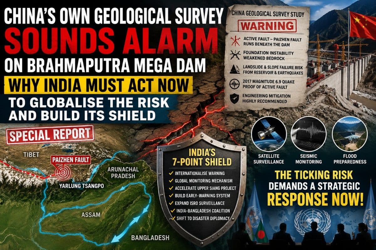
A study supervised by the state-backed China Geological Survey has concluded that the world's largest hydropower project is being built over the active Paizhen Fault in one of the most seismically volatile regions of the Himalayas, warning of weakened bedrock, unstable slopes, earthquake-triggered landslides and structural risks to the dam and its reservoir.
What China's Own Geological Survey Has Warned
- Active fault beneath the project: The Paizhen Fault runs through the construction and reservoir zone and has remained tectonically active since the Pleistocene.
- Foundation instability: Fault activity has fractured surrounding rocks, reducing their bearing capacity for mega infrastructure.
- Reservoir-induced slope failures: Long-term water storage combined with earthquakes could trigger landslides and slope collapses around the reservoir.
- Recent seismic evidence: The study cites the 2017 magnitude 6.9 Magnitude earthquake as proof that the fault remains active.
- Engineering mitigation required: The researchers recommend reinforced slopes, retaining structures and enhanced structural safeguards throughout construction and operation.
The significance of this disclosure extends far beyond Chinese engineering. It transforms the Brahmaputra issue from a diplomatic disagreement over an upstream mega project into a downstream disaster-preparedness challenge for India.

📱 Get Argus News App
✨Since Beijing appears determined to proceed despite its own geological assessment, New Delhi can no longer rely solely on bilateral engagement. It must treat this study as an opportunity to build an international, scientific and strategic response before the reservoir becomes operational.
What India Should Do Immediately
1. Internationalise China's Own Scientific Warning
This is no longer India's allegation. It is a risk documented by a study supervised by the China Geological Survey. New Delhi should circulate the study among the United Nations system, international disaster-risk agencies and major multilateral forums to press for greater transparency and independent scrutiny of a project with transboundary consequences.
2. Seek an International Seismic and Hydrological Monitoring Mechanism
India should propose continuous third-party monitoring of seismic activity, reservoir behaviour and river discharge around the Yarlung Tsangpo project. Independent observation would improve transparency and provide early warning for downstream countries.
3. Accelerate the Upper Siang Multipurpose Project
Beyond electricity generation, the project should be developed as a strategic flood-buffer capable of moderating sudden surges if extreme releases or geological events occur upstream.
4. Build a Himalayan Early-Warning Shield
India should integrate seismic stations, automated river gauges, satellite monitoring, AI-based flood forecasting and emergency communication systems across Arunachal Pradesh and Assam to maximise evacuation time during any upstream emergency.
5. Expand ISRO Surveillance
Continuous InSAR and satellite monitoring can detect millimetre-scale ground deformation around the Paizhen Fault and reservoir, giving India an independent assessment rather than relying on official Chinese disclosures.
6. Build an India-Bangladesh Scientific Coalition
Both countries are downstream stakeholders. Joint technical assessments, data-sharing and coordinated disaster planning would strengthen regional resilience and reinforce calls for greater transparency.
7. Shift from Water Diplomacy to Disaster Diplomacy
Since China is constructing the project within its territory for domestic purposes, the more immediate priority is ensuring that geological risks with potential cross-border consequences are recognised internationally and incorporated into disaster-risk reduction frameworks.
Bottom Line
The biggest development is not that China is building the world's largest hydropower project – it has been known for years.
The real turning point is that Beijing's own scientific establishment has publicly identified major geological hazards associated with the site while construction continues.
For India, that changes the strategic calculus. The Brahmaputra can no longer be viewed solely through the prism of hydropolitics or border tensions. It now demands a comprehensive strategy combining international diplomacy, scientific monitoring, resilient infrastructure and disaster preparedness.
The question
is no longer whether India can stop the project. The challenge is whether it
can build an effective shield before the risks identified by China's own
geologists become an operational reality.
Also Read: Pakistan's J-35 Stealth Fighter with LD-8A Missiles Could Challenge India's S-400 Air Defence Shield| Defence Update
Related Topics
Explore more stories