



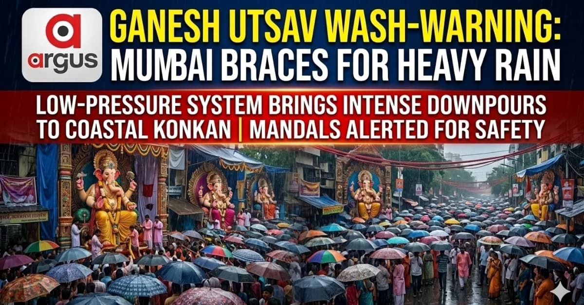
EXCLUSIVE | Mumbai Weather Alert: Heavy Rain Spells Forecast for September 14; Ganesh Utsav Processions May Face Traffic Snarls
Key Points
Global weather models and IMD tracking point to an active low-pressure system moving from Odisha towards Maharashtra, raising the prospect of heavy rain just as Ganesh Utsav celebrations peak
Bhubaneswar: Heavy rain spells are set to dampen the spirit of festive revellers in Mumbai and across Maharashtra this Ganesh Utsav.
Devotees celebrating the festival may need to keep their umbrellas close, as active monsoon conditions are forecast to bring intense downpours to the city and coastal Konkan belt on Monday, September 14, 2026.
The latest weather-model projections suggest that while the festival is unlikely to face a complete washout, periodic heavy downpours could coincide with peak movement of devotees, creating the possibility of traffic disruptions, slow vehicular movement and localized waterlogging.
The India Meteorological Department (IMD) has maintained a Yellow Alert for Mumbai and the Konkan belt, with the possibility of thunderstorms, lightning and localized waterlogging in vulnerable, low-lying urban areas.

📱 Get Argus News App
✨The Meteorological Trigger: Low-Pressure System Advancing West
The main weather trigger behind the expected wet spell is a well-defined Low-Pressure Area. Initially positioned near the south Odisha coast, the system is tracking west-northwestward across Central India.
As the system moves towards Maharashtra and adjoining parts of Gujarat around September 13-14, it is expected to draw moisture from the Arabian Sea. This interaction could strengthen rainfall activity along the western coast, particularly over the Mumbai-Konkan belt.
The forecast therefore points towards an active monsoon pattern rather than merely isolated, pleasant showers. However, the exact timing and intensity of individual rain spells can still change as the system moves closer to Maharashtra.
Model Analysis: Regional Rainfall Breakdown
The latest projections indicate that the strongest rainfall signal for September 14 is concentrated over Mumbai and the coastal Konkan belt, while rainfall intensity is expected to gradually decline farther inland.
September 14 Rainfall Projections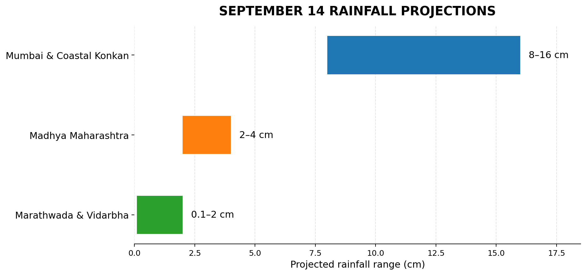
Mumbai
& Coastal Konkan: 8–16 cm
The GLB model of NCMRWF indicates a distinct heavy-precipitation cluster over the Mumbai-Thane-Palghar corridor.
The rainfall signal suggests that the city could experience intense spells of rain interspersed with comparatively quieter periods, rather than continuous rainfall throughout the day.
The GFS and ECMWF models also indicate an active precipitation signal along the western coast, with projected rainfall rates in the range of 3–6 mm/hour during active spells.
Madhya Maharashtra: 2–4 cm
As the system progresses across the region and interacts with the Western Ghats, rainfall intensity is expected to weaken.
Areas such as Pune and Nashik could see light to moderate showers, with short-duration disruptions possible during heavier spells.
Marathwada & Vidarbha: 0.1–2 cm
Central and eastern parts of Maharashtra are expected to remain largely on the outer periphery of the system.
The rainfall signal here is considerably weaker, with isolated light showers or drizzle more likely than widespread heavy rain.
Heavy Spells, Not Necessarily a Washout: The Real Risk Is on the Roads
A projected daily accumulation of 8–16 cm does not necessarily mean continuous rain for 24 hours.
Instead, Mumbai could see waves of heavy downpours separated by relatively dry or lighter-rain windows.
But the timing of those spells matters.
With Ganesh Utsav being the most popular festival in Maharashtra, large crowds are expected on the roads, even short periods of intense rain could have an outsized impact on urban mobility. Traffic congestion, slower vehicular movement and localized waterlogging could become the bigger problems for devotees and commuters.
Low-lying and historically vulnerable locations such as Hindmata, Sion and the Andheri Subway could face particular pressure if intense rain coincides with peak traffic.
For procession organisers, therefore, the concern is not simply whether it will rain, but whether a heavy spell arrives at the same time as large crowds are on the move.
Essential Safety Advisory for Mandal Organizers
With the rainfall signal strengthening for September 14, festival organisers should review electrical, structural and crowd-safety arrangements in advance.
Electrical and Fire Safety
Elevate main wiring: Route power cables, junction boxes and extension cords overhead wherever possible. Avoid running electrical lines along the ground in areas where water could accumulate.
Waterproof connections: Protect joints, switches and sound-system connections using suitable waterproof enclosures.
Check grounding: Ensure that metal structures, scaffolding, stages and high-wattage LED frames are properly grounded to reduce the risk of electrical leakage.
Structural Resilience
Reinforce canopies: Inspect pandal roofs for sagging pockets and ensure tarpaulins are tightly stretched so rainwater can drain quickly instead of accumulating overhead.
Secure banners and decorations: Tie down or lower large overhead banners, cutouts and loose decorations that could become hazardous during strong wind and rain.
Create anti-slip walkways: Use coir mats, rubber flooring or wooden planks along entry and exit queues to reduce the risk of slips on wet surfaces.
Crowd Management
Create covered holding areas: Designate sheltered zones where devotees can safely wait during sudden heavy downpours without blocking procession routes or creating crowd pressure.
Keep evacuation paths clear: Emergency exits should remain unlocked, well-lit and free from festive stalls, equipment and other obstructions.
Monitor weather updates: Organisers should keep a designated person in contact with local authorities and continuously monitor IMD warnings during procession hours.
Bottomline: Rain May Come in Waves, But the Disruption Could Be Sudden
The September 14 forecast does not point towards an all-day deluge across Mumbai. But the combination of an active westward-moving weather system, a strong coastal rainfall signal and peak Ganesh Utsav crowds makes short-duration heavy rain a significant logistical concern.
For Mumbai, the crucial question may therefore not be “Will it rain?”, but “When will the heaviest spell arrive?”
If
the intense rain bands coincide with the peak turnout hour and
evening traffic, even a temporary downpour could translate into
waterlogging,
traffic snarls and crowd-management challenges.
Also Read: Special Report| ISRO's Warning For Odisha, AP, WB: 2026 Oct-Nov Cyclones to Pack Double the Punch; Another 1999 Super Cyclone in Making?
Related Topics
Explore more stories