Early Monsoon Exclusive / Beyond the Cyclone Scare: How a Brewing Bay System is Secretly Fast-Tracking the 2026 Monsoon onset over Keralam, Andaman
Key Points
Bhubaneswar: While several news channels are currently "shouting" about a GFS-predicted cyclone in the Bay of Bengal, the raw deterministic maps from country’s top model forecasters – IMD and NCMWRF – tell a more nuanced story.
When there has been growing fear of an impending storm in the mind of common man, the reality is the system is expected to strengthen the Monsoon Engine, and facilitate its early onset.
NCMRWF and IMD extended range charts suggest a massive structural shift in the atmosphere between May 10 and May 20. What tale they tell.
· Cross-Equatorial Airflow 850 hPa: The "Monsoon Engine" is fueled and ready.
· The Reality is the Somali Jet is waking up
· Middle East Ridge 500 hPa: The "Heat Block" preventing early rains in Rajasthan/Gujarat.
· North India Trough 700 hPa: The "Relief Valve" for Odisha; triggers Kalbaishakhi.
· SE Bay Circulation Surface/925: The "Accelerator" dragging the monsoon toward India.
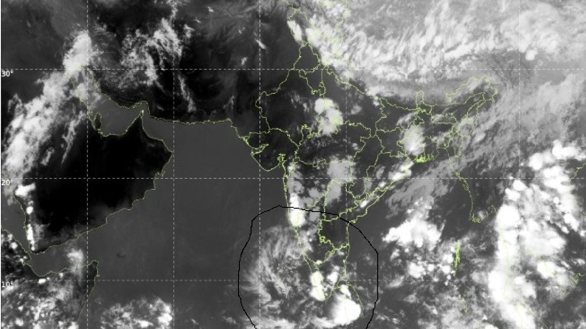
· The Kerala/Karnataka Vortex: The cyclonic circulation near the West Coast at 500 hPa is seen as the "Monsoon Onset Vortex." This is the classic signature of the monsoon's first gear.
The "Monsoon Booster" vs. The Cyclone Hype
· The Pan-India Prediction: An Early Pulse
The maps show a robust "pulse" of moisture moving from the Southern Hemisphere into the Arabian Sea and Bay of Bengal.
An analysis of the IMD and NCMWRF deterministic map data reveals the following.
📱 Get Argus News App
✨The Andaman Push: Current synoptic signals (the 925 hPa cross-equatorial flow) suggest the monsoon will likely arrive over the Andaman & Nicobar Islands by May 15–18, which is 3–4 days ahead of schedule.
Kerala Onset: If the cyclonic circulation near the West Coast (at 500/700 hPa) holds, it will pull the monsoon pulse toward Kerala by May 25–28. This "early onset" isn't just a guess—it's driven by the cross-equatorial airflow clearly discernible in the deterministic maps.
Debunking the Bay of Bengal "Cyclone"
While GFS models are "shouting" about a storm, in fact, the system suggest its utility otherwise.
The Atmospheric Pump: Even if the system over the Southeast Bay of Bengal doesn't reach severe cyclonic intensity, its mere presence acts as a vacuum. It draws the South-West Monsoon winds deeper into the Bay, effectively "locking in" the monsoon current earlier than usual.
Model Divergence: When GFS predicts a major storm (aggressive instensification), ECMWF and NCMWRF suggest a weaker, broad-based circulation. This indicates a "monsoon depression" or "monsoon low" rather than a destructive pre-monsoon cyclone.
The Odisha Impact: The Heatwave Relief Valve
How the synoptic features of the IMD and NCMWRF deterministic maps play out for Odisha.
Temperature Suppression: Unlike the brutal heat of April, the Trough over North India at 500 hPa is allowing moisture from the Bay to penetrate Odisha.
Heatwave vs. Humidity: While Western Odisha (Sambalpur, Bolangir) may still touch 43-44°C due to the Middle East/Iran Ridge, Coastal and Central Odisha will see frequent evening thunderstorms, keeping peak temperatures near 38-40°C.
Pre-Monsoon Rain: The deterministic maps forecast a significant surge in thunderstorm activity between May 12–15 as the Bay circulation begins to intensify.
PAN INDIA PREDICTION
While the South cools down, the "Ridge over the Middle East" is the real story for North and West India:
Odisha/Bengal Relief: The trough over North India, interacting with moisture from the Bay, will continue to trigger Kalbaishakhi (Nor'westers). This keeps the "Heat Dome" from settling permanently over the East Coast.
Central
India Warning: The Iranian ridge acts as a "heat blocker,"
potentially pushing temperatures to 44–46°C in Vidarbha and Rajasthan just
before the monsoon arrives.
Also Read: EXCLUSIVE:Why Odisha Faces a Sizzling Humidity Spike Instead of a May Cyclone
Related Topics
Explore more stories