



Cyclone Update / Cyclone Arnab Moving Westwards at 22 Kmph; Landfall Near Yanam Likely Tomorrow
·1 hour ago·2 min read
Key Points
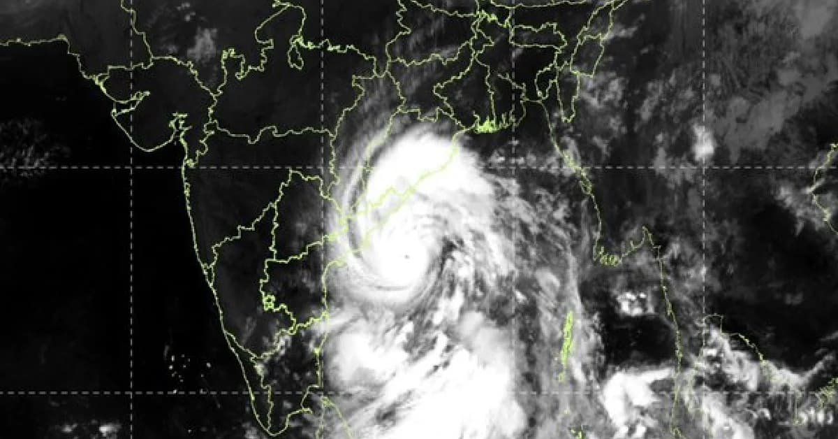
Very severe cyclonic storm Arnab over the west-central Bay of Bengal is moving westwards at 22 kmph and is expected to cross the Andhra Pradesh coast near Yanam by the forenoon of October 28, according to the IMD bulletin issued at 5.30 am on October 27.
Bhubaneswar, Oct 27: Very severe cyclonic storm Arnab over the west-central Bay of Bengal is moving westwards at 22 kmph and is expected to cross the Andhra Pradesh coast near Yanam by the forenoon of October 28, the India Meteorological Department (IMD) said on Tuesday.
According to the IMD bulletin issued at 5:30 am on October 27, the cyclone was centred over the west-central Bay of Bengal, around 260 km southeast of Visakhapatnam, 300 km east-southeast of Kakinada and 380 km south of Gopalpur in Odisha.
The storm is likely to continue moving west-northwestwards until Tuesday evening before turning northwestwards. It is very likely to cross the Andhra Pradesh and Yanam coasts between Bapatla and Visakhapatnam, close to Yanam, by the forenoon of Wednesday, October 28.
At the time of landfall, the cyclone is expected to bring maximum sustained wind speeds of 115-125 kmph, with gusts reaching 140 kmph, the IMD said.

📱 Get Argus News App
✨📰 60 Word News🎬 Argus Podcast📺 Live TV and Breaking News🔔 Free Notification Alerts
Download Free:
With the storm approaching the Andhra Pradesh coast, adjoining coastal areas of southern Odisha remain under a cyclone warning. The system's movement and proximity to the Odisha coast warrant close monitoring of weather conditions and official advisories.
Also Read: Cyclone Arnab Intensifies Into Very Severe Storm, South Odisha On Alert
Orange Alert For Six Odisha Districts
The IMD has issued an orange warning for heavy to very heavy rainfall at isolated places in Ganjam, Gajapati, Rayagada, Koraput, Malkangiri and Puri districts over the next 24 hours.
A yellow warning has been issued for Nuapada, Balangir, Kalahandi, Kandhamal, Boudh, Nayagada, Khordha, Kataka, Dhenkanal, Anugola, Kendujhar, Mayurbhanj, Baleshwar, Bhadrak, Jajpur, Kendrapada and Jagatsinghpur, with heavy rainfall, thunderstorms, lightning and gusty winds possible in parts of these districts.
Rainfall linked to the cyclone’s outer bands has already begun in parts of Puri, Ganjam, Gajapati, Rayagada and Khordha districts, the weather agency informed.
Related Topics
Explore more stories